![]() :
Picture from video capture
:
Picture from video capture
Tornadic Chase Through Kansas, Nebraska and Wyoming (Dave Lewison and Chris Kridler)
Click any image to enlarge to full size...
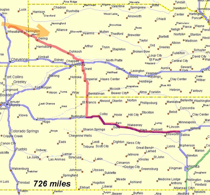
Our path through Kansas, Nebraska and Wyoming, and back to Nebraska is shown here in red. The orange arrow indicates the approximate path the storm took. |
MAKING OF THE CHASE: Started the day after a good night's rest in Salina, KS. There was a MDT Risk out for most of the NE panhandle and eastern WY. A major surface low was developing across the rockies and was situated near southwestern Wyoming. This low was bringing in backed surface winds from the SE. Dewpoints were not progged to be that high (low 60's), but the upslope flow looked as if it could break the cap enough for storms to get going. We made our way west on I-70 for a few hours into the town of Colby, where we stopped at the local library to get some data. SPC had shrunk the MDT a bit to only include the panhandle of NE, but this still seemed like a good chase day. So, it was north towards Ogalalla, NE.
|
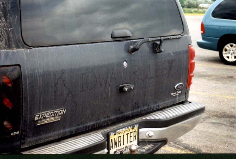  |
Once in Ogalalla, we stopped at a truck stop to plug in for some data.
While there, we ran into chasers David Fogel and Keith Brown. (Keith had written his
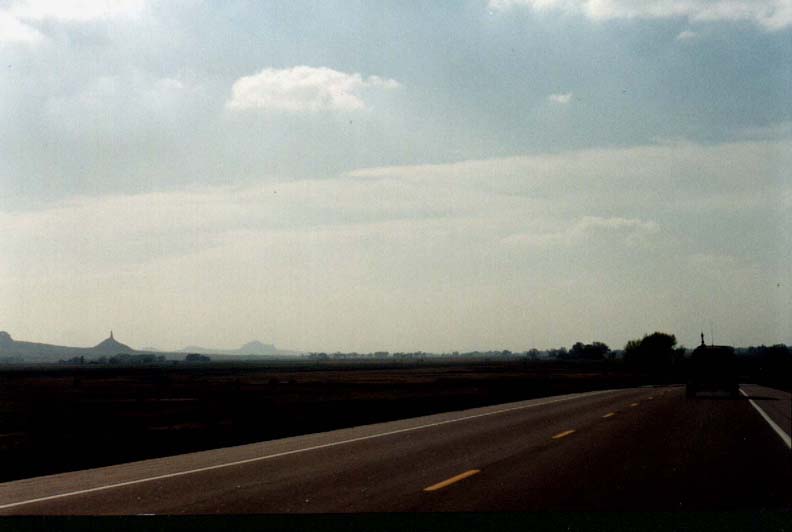
opinion of the Iowa storms a few days before on David's Ford Expedition). Surface winds were still backed and there was some indication that the cap was eroding further to our NW, near the NE/WY border. So, we decided to head up I-26. Along the way, we began to see the anvils of the distant storms. They looked a bit unorganized but started to look a bit better as we approached. |
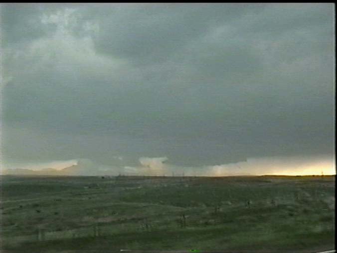  |
We crossed into WY still headed NW on I-26. We finally arrived near the
base where we could make out what looked like TWO wall clouds at the same time. This was
very interesting! The wall cloud to the right seemed to be getting better organized. As we drove closer to it, a funnel appeared. |
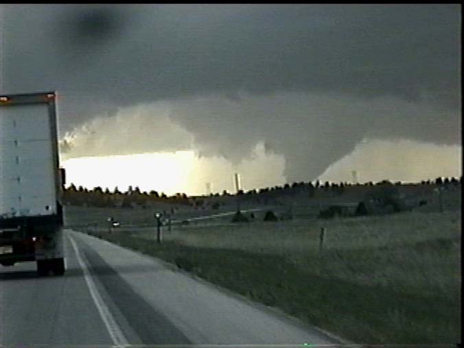  |
Now, this surely looks like a big tornado, doesn't it? Well, in fact, it was just a real mean-looking funnel cloud that looked like it was touching the ground due to all the high terrain around us. |
  |
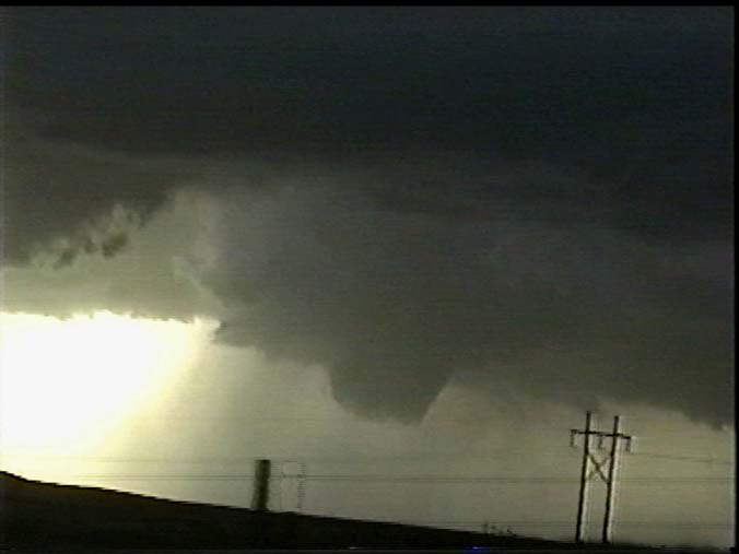
However, we pulled off on a high spot just SW or Guernsey, WY to watch it.
Before long, what looked like an RFD blast cut into the wall cloud spinning up another
funnel..... ....that slowly snaked its way down..... |
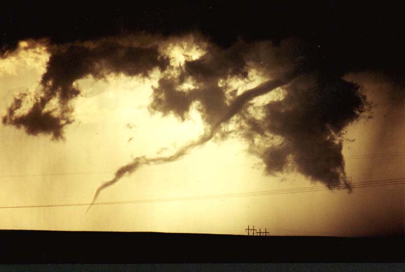 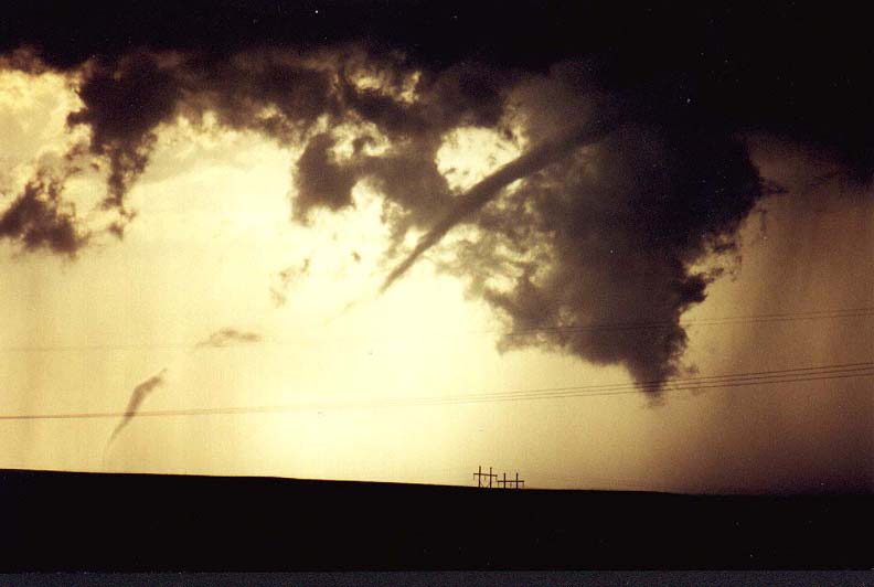 |
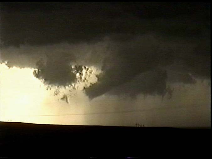
...until it FINALLY touched down! It gradually roped out, all the while having the "tail" dragging across the ground. Very pretty! |
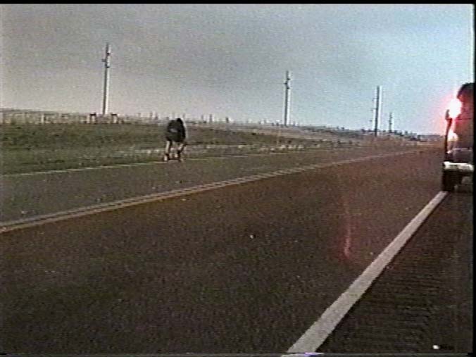 |
After this gorgeous display, we continued watching for a while until the hail approached. We were hit with quarter-size hail as we fled back north and east. Other chasers were out collecting the hailstones...yikes! |
 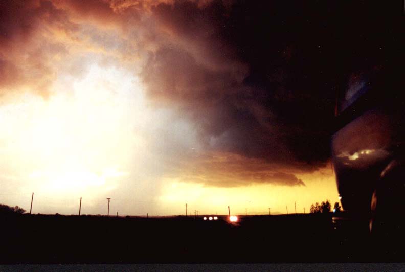 |
A bit further north, we pulled off again to watch. The storm kept trying
to put out weak mesocyclones, but nothing looked too organized. We were treated to an
amazing sunset underlighting the storm's base. An oncoming freight train added a nice
little touch to the picture. Not to be outdone, the sun then cast an eerie pink glow on the precip area, giving spectacular color to the sky. These pictures don't do it justice. It was incredible! |
| SUMMARY: Fantastic day! Seems kind of strange because I wasn't all that impressed by the appearance of the storm's anvil when we were coming up I-26. It looked really ragged and weak. Even the wall cloud wasn't all that well organized, but it still managed to produce! I was even more impressed by the awesome display of colors near sunset. I'm sure glad I had my good Nikon N-70 SLR with me this day! |
|
May 11 | May 12 | May 16 | May 17 | May 18 & 19 | May 22 | May 24 | May 25 | May 26 | May 27
Email me at: lewisd2@rpi.edu