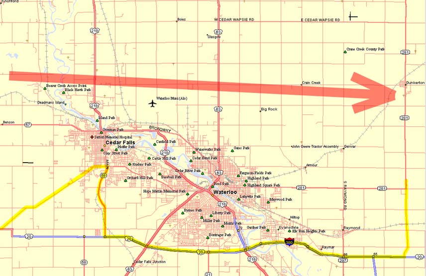
Our crazy path once we neared Waterloo is shown here in yellow. The estimated mesocyclone path is shown with the red arrow. Click to enlarge. |
THE MAKING OF THE CHASE: We started the day in Junction City, KS after having driven up all the way from Lubbock, TX the day before. There was a slight risk out for the NE Iowa and southern MN areas. Our target area was east central Iowa. We started out at 9:30 east on I-70 and then NE past Kansas City to I-35 in Missouri. Headed north into Iowa on I-35 into Osceola at about 3pm where we plugged in the laptop for the latest updates. The low was still in western Iowa west of Des Moines, with its attendant warm front stretched east-west across northern Iowa near HWY 20. Surface winds east of I-35 were mostly southerly, but backed to the SE further north and east of Des Moines. Dewpoints in the area were in the high 60's, CAPE was in excess of 4000 J/Kg, and the RUC indicated the cap was breakable in NE Iowa. The latest weather advisory stated that the cap was strongest south of HWY 30, and that storm initiation would likely occur more north near HWY 20, which is what we'd expected from our analysis. So, we set a preliminary target area of Waterloo. Headed NE on 330 into Marshalltown and then N until we hit 14. Turned east and began noticing more convective activity as towers began eroding the cap. We pulled off on a high dirt road just west of Grundy Center at around 5 pm to watch things for a while. One area of turkey towers kept percolating over the same area. We spent about 45 minutes watching the towers rise and then dissipate. A few more quick cell phone calls to Cheryl Chang and Steve Sponsler verified that there was nothing else going on nearby and that our location seemed to be a good spot. At 6:06 pm we heard the tornado watch go out on the weather radio. The turkey towers were now much more consolidated. I looked away for about 5 minutes to do some camera stuff. I looked back and was impressed by what I saw....there was now a bomb tower rocketing up the side of the previous towers. It anviled off in no time at all and was followed by another bomb tower. A STORM WAS FORMING RIGHT BEFORE US! We decided to head out north on 14 and then east on HWY 20 towards Waterloo. |
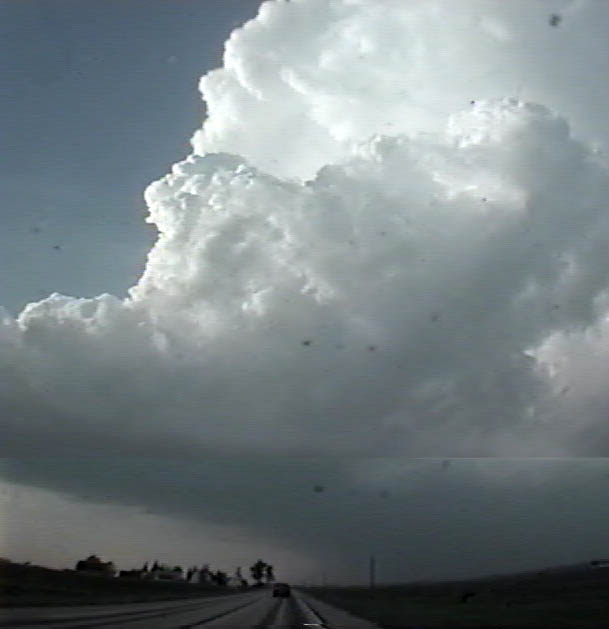  |
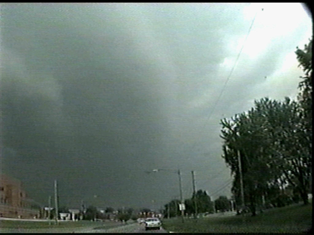
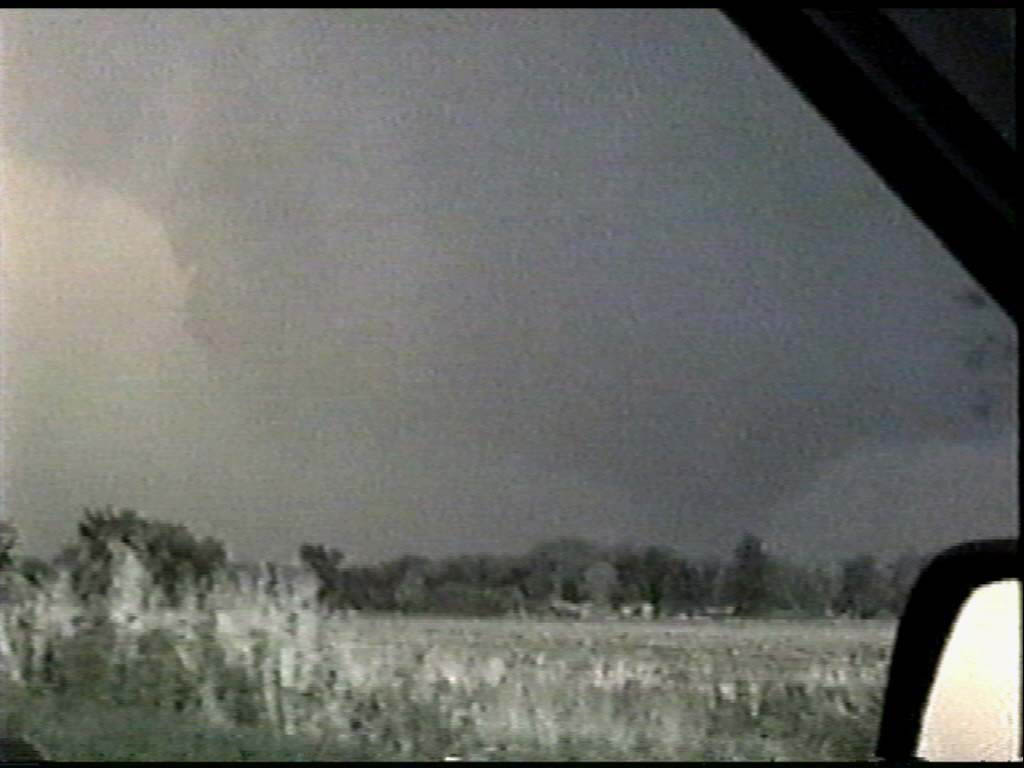
The storm got right down to business very quickly. This is the view at
about 6:30 heading north on 14. Nice shearing towers and flanking line. A distinct
lowering where the two met. We decided to head NE instead of east on HWY 20...Just west of Cedar Falls, we pulled off to witness the formation of a wall cloud. Time is about 6:50 pm. |
  |
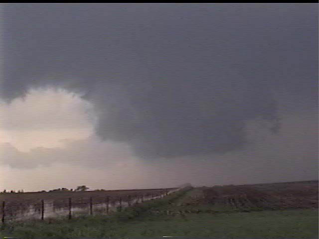
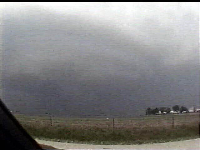
As it drifted east, this wall cloud became hard to see against the
darkening precip core. A rather obvious clear slot formed and wrapped around the wall
cloud, which promptly formed a dark bowl-shaped lowering. We had to get east....Unfortunately for us, Cedar Falls was only 3 miles east of us. We ran smack into traffic in this much-larger-than-expected town. I think it was at about this time (7:10 pm or so) that the incredible wedge formed from that wall cloud north of Cedar Falls that was featured so prominently on The Weather Channel and by Roger Hill. We lost sight of it and were more concerned with the new mesocyclone that had formed to the ESE of the old one. This was the view driving east through downtown Cedar Falls. Look at the round cloud striations with this meso. It had a nice "mothership" appearance. |
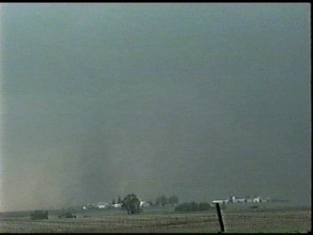  |
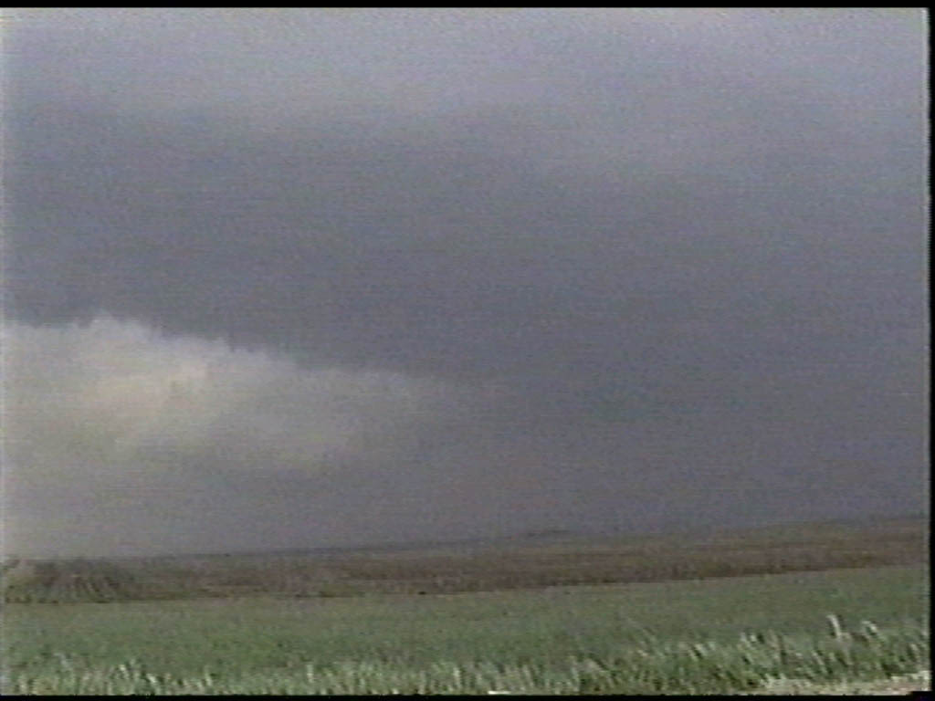
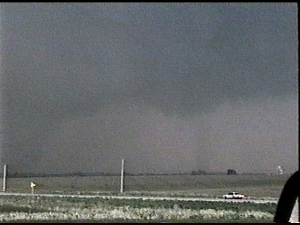
After another 10 minutes, we had cleared Cedar Falls and headed back east
on HWY 20 to try to play catch up with the new meso. We turned north past Waterloo on 281,
south of Dunkerton. We headed north about 10 miles and pulled off to watch. It looked like
there was a dust column concentrating off to our NW, but we couldn't be sure. Time here is
about 7:32 pm. I think this was the beginning stages of the next "stove pipe"
tornado. However, again, the lowering became hard to see against the precip core. We probably could have gone further north to get east of it for a better view, but the GPS was not up and running and we weren't sure of an escape route. This meso exhibited violent rotation for quite a while. |
 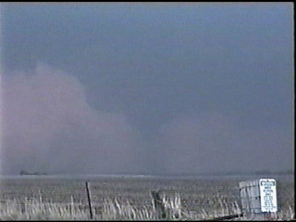 |
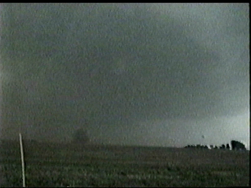
This is the same lowering illuminated by lightning. Shortly thereafter, we noticed that it seemed awful dark under that lowering. In a brief flash of lightning, we could see why. There was a large tornado on the ground just east of Dunkerton! There was also another lowering right behind this one...since we were completely unsure if we had a lengthy east road option, we decided to see what this lowering would do. |
  |
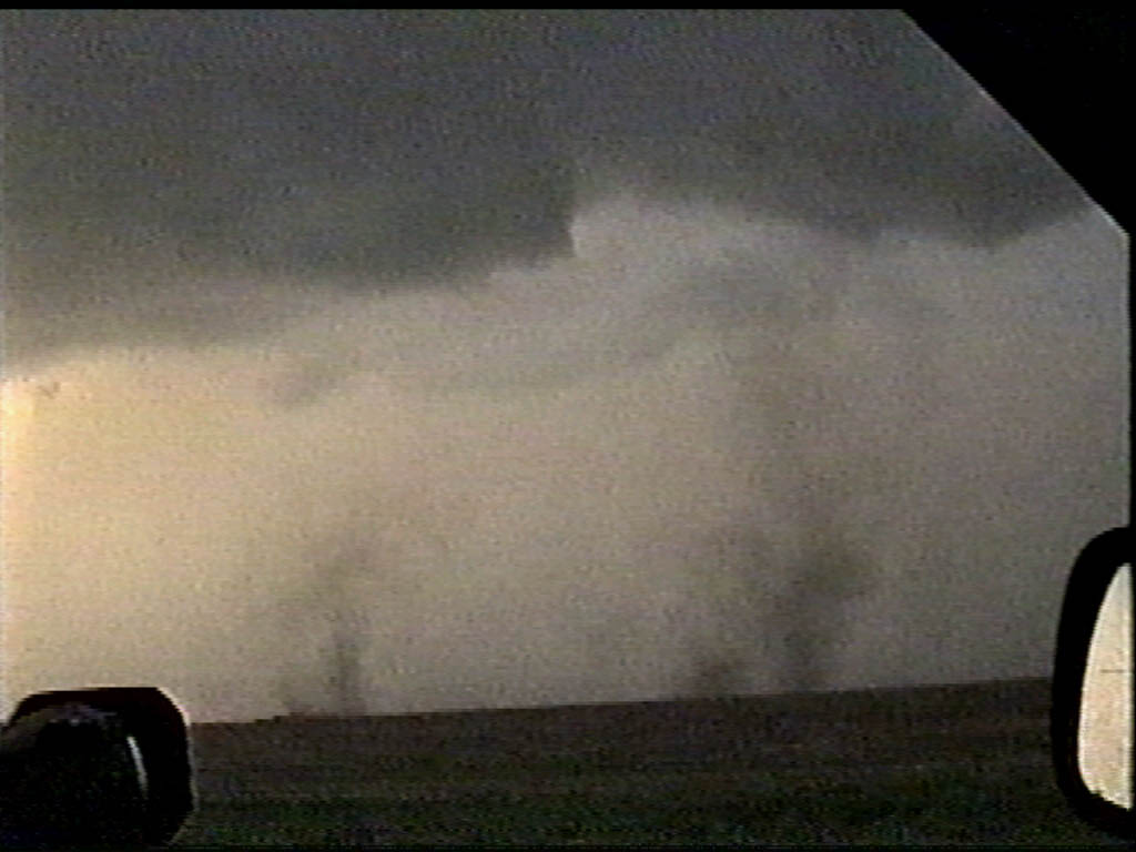
Before long, another blast of RFD cut into this newer base. It was amazing
to watch the meso crank up when this happened. The sharp left edge was showing violent
uprising motion. This was a large bowl tornado with lots of dust beneath it, but no
condensation funnel all the way to the ground. A tornado, nonetheless. We also noted a couple of satellite funnels racing around the outside edge of the circulation. Some of these even touched down. |
  |
A surprise touchdown in a field less than 1/2 mile away. We were not sure where this one came from! Shortly after that, a curious small-scale downburst event kicked up dust all the way to the cloud base. There was no rotation evident, but it was neat to watch. |
| SUMMARY: Well, this chase could have been a lot better. I found it difficult to navigate around this storm and get into position. I think part of this was my inexperience with reading a storm in less-than-perfect lightning conditions. This storm also cycled rather quickly, going through 3 or 4 mesocyclones in the course of 90 minutes. This made it tough to be in the right place at the right time. However, I really think this chase would have been more successful had our GPS been up and running. We would have been able to plan our road options far better. So, not a bad day, but it could have been much better. |
|