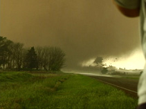
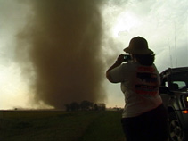
May 12, 2004 Chase Summary (Click any image to enlarge) Chasers: Dave Lewison, Chris Kridler, Scott McPartland, Pete Ventre, Mark Robinson, Dave Sills, Sarah Scriver Many thanks to Jason Politte for timely & accurate nowcasting today! VIDEO CLIP (WMV format, 2m33s, 4.9 MB) The May 12, 2004 Attica, Kansas tornado footage is available for licensing through StormStock, please contact them directly at (817) 276-9500 or via StormStock Email |
||
| MAY 12, 2004:
Certainly one of my best chase days ever! 3 1/2
tornadoes (the 1/2 was a brief satellite), and some very
memorable video...read on.... Started in Colby KS after the previous day's total bust in southern Nebraska. Things were looking decent, but about as they did the previous day, so we were cautiously optimistic. The system that had given us so much hope the day before, was sinking southeastward into western KS, with a triple-point progged to set up in S.C. KS near the Medicine Lodge area. A distinct dry push was poised to move into some really juicy air, and a warm front meandered ENE from the low center. The RUC was insisting on breaking out isolated precip west of Med. Lodge, so that seemed like the place to go! Conditions at Colby in the morning were cold and sunny with N winds, but they veered around to NE and then ESE as we progressed southward on KS83. Good, the front was not surging southward as we had feared. |
||
|
Coming down 83 out of Colby, we took a break at a Pizza Hut in Garden City. Scott had his "usual" treat of chocolate pudding. Scott's constant obsession with pudding led me to title my 2004 Highlights DVD "Better Than Pudding". :-) |
South of Garden City, we stopped briefly for some pictures of my favorite radar site. Is sure looked different than it did 3 years ago!! |
We miraculously found an open WiFi network at a gas station, so Dave pulled up the latest model runs. Things were still pointing towards Medicine Lodge. |
|
Hmmm....Where to go? At a gas station in Sublette, the crew decides on the next move: south to KS160 and then eastward! |
Around 5:30 PM: Heading east on KS160 east of Meade, the first inklings of a Cb. |
20 minutes later we had this. |
|
Followed in 5 minutes by this. |
...and then this. Isn't this a chaser's dream? A beautiful, lone supercell with explosive growth, within reach, and a road leading RIGHT TO IT! |
We stopped for a few pictures near Wilmore as the storm anviled off nicely. |
|
We stopped just west of Medicine Lodge to take a gander at the base. It looked quite nice, a stacked-plate appearance...almost LP'ish. |
But there was a new cell going up to its southeast. It too grew explosively. This was the beginnings of the (in)famous Attica/Harper tornado machine. |
7:03 PM: Tornado! We had been watching the northern storm try to produce lowerings, and then noticed this long rope hanging out the backside of the southern storm. |
|
A radar image of the storm(s) at the time of tornadogenesis. Our location and viewing direction is indicated by the pink dot & lines. Many thanks to Gibson Ridge Software for producing this image from NCDC archives. |
The first tornado still on the ground north of Sharon KS around 7:10 PM. Realizing that the southern storm now was clearly becoming dominant, we continued blasting east on KS160 through Medicine Lodge. |
We entered Attica, dodging absolutely humongous hail. Somehow, we avoided losing the windshield. |
|
Looking south from KS160 in Attica, the occlusion and beginning funnel are clearly visible. |
East side of Attica on US160, looking south. Dust swirls form beneath a rapidly rotating wall cloud. A distinct waterfall-ish sound was emanating from overhead continuously. Very surreal. |
Same position. Large truncated cone tornado about 1/3 mi to the SW. At this point we could clearly hear the tornado. The following is an amplified excerpt from my video. The car's A/C is not running and there are no power lines around. The sound was coming directly from the tornado, and seemed to be emanating from the rotating wall cloud overhead! |
|
7:55 PM: Radar image and video timestamp are the same here. Again, our position/direction is indicated with pink lines. |
This tornado was not moving east with the parent storm. It was moving NORTH, directly towards us! We booked about another 1/2 mi east on KS160. |
We stopped as the tornado was getting ready to cross the road about 1/2 mile or so behind us to the west....right where we had just been. |
 1 mi east of Attica, looking W. The tornado getting ready to cross KS160. An unfortunate two-story wood frame house on the east side of Attica is about to get severely damaged. |
 An inflow jet from the northeast rips into the house.. |
 The roof was de-shingled, and then lofted into air. It never appeared to hit the ground. |
 It disintegrated into thousands of pieces of debris in mid-air Report was called into county Sheriff's dept. for assistance. |
 Pieces of the house were wrapping around the south side of the tornado at incredible velocity. |
 Thank goodness the house's residents were unharmed in their basement! Damage was later rated F2 due to complete removal of the roof, with 2nd-story walls left intact. |
|
In this 35mm still photo (my favorite), the tornado is ON TOP of the two-story wood frame house on the east side of Attica. That's Scott McPartland behind his XTerra, shooting what would become the famous video shown all over The Weather Channel the next day. |
8:03 PM: Radial velocity image of the storm at the time this photo was taken. Distinct, albeit small, velocity couplet. Our position is indicated in pink. |
Same position (1 mi east of Attica), looking NW. Tornado ropes out, moving NW. |
|
With that impressive show over, we continued east on 160, as the next mesocyclone got cranking. |
8:17 PM: Now about 7 mi E Attica on US160, looking S. A tornado descends from a seemingly flat, but much larger base. |
Same position. The tornado moves ENE south of the hwy. There is a farmhouse at the end of the dirt road near the trees. It was not damaged. |
 8:20 PM: Radar image at the time this photo was taken. Again, our position is in pink. What an amazing hook!!! |
Continuing east on 160 to beat the hook precip...This tornado morphed into another large dusty stovepipe. |
While driving, a satellite tornado spins up about 1/4 mi to our east, while the main tornado churns in the field to our south! This satellite passed over US160 immediately ahead of us, heading SW before dissipating. A nearly pants-filling moment. :-) |
|
8:24 PM: We reach the end of the road. KS 160 turned due north. KS 2 went due south, with NO EAST roads! Looking at the massive hook on radar, you can see how screwed we were. The inset photo shows Scott and I discussing (very quickly) where we should go next, with the tornado becoming rain-wrapped behind us to the south. We played it "safe" and took 160 north, since we weren't sure if we could beat the tornado before it crossed Hwy 2. |
Now 9 mi E Attica, or 3 mi SW Harper. The large stovepipe tornado is still visible beneath an incredible mesocyclone structure.
|
We gradually lost sight of the tornado, as the FF core engulfed us with golfball hail. There was nowhere else to go but straight east, so we pulled away from the storm. Finally turning south towards Argonia, we pulled off for some lightning shots and then headed to Enid for the night. |
This map reconstructed from damage survey data provided by the NWS in Wichita KS. |
||


