
Tornadic Chase Through Eastern TX Panhandle (Dave Lewison on Cloud 9 Tours)
| I said my farewell to Chris Kridler on Monday, and joined up with Cloud 9
Tours for the next three weeks. On May 20, we started in Amarillo, having eaten at the Big
Texan the day before. Headed east on I-40 to get data in Shamrock. Chris Kridler was also
there and we discussed plans for the chase that day. The best convergence and upper air
support looked to be a bit further south. Ahead of the advancing dryline Td's were in the
upper 60's with SSE winds at the surface. There was a bulge in the dryline and a big
moisture convergence bullseye in front of it. So, after toilet papering Chris' car (we have a lot of fun on the tours!) we headed south on 83 about 20 miles to watch. We waited about an hour before seeing a good anvil up to our NW, so we headed back again to I-40 and then west. |
|
 |
On I-40 westbound, cloud streets were lining up from the SSE, feeding into the direction of the target storm. |
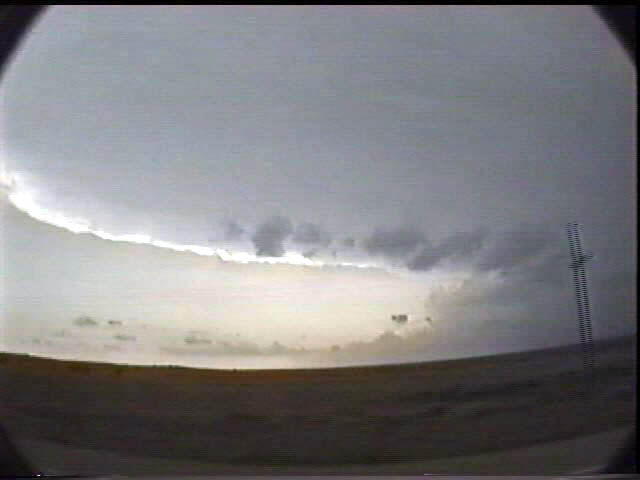  |
A view of the storm to the WNW of I-40 on wide angle. A nice crisp and circular backsheared anvil with inflow bands curving into the base. Quite a bit closer, we saw a menacing wall cloud hanging over the prairie. |
 
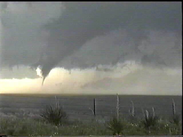 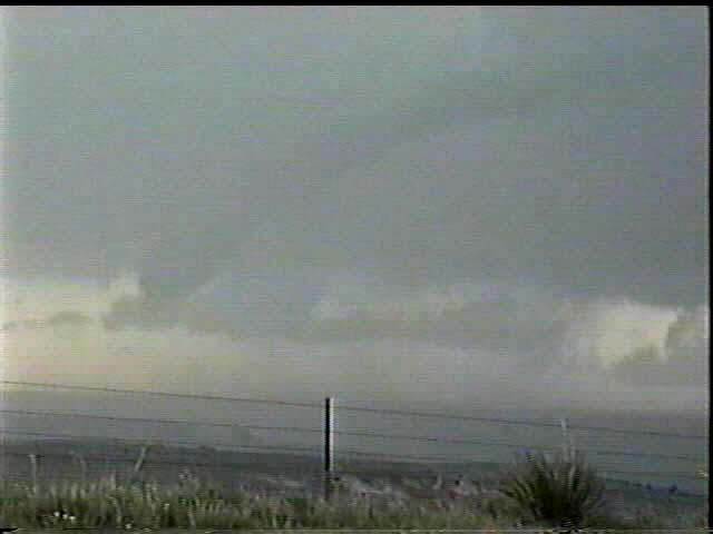 |
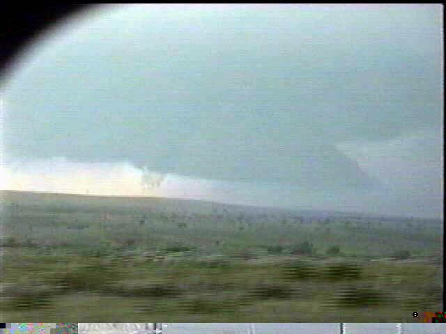
We pulled onto a northbound road near Jericho, TX to watch things for a while. An impressive RFD blast cut into the base, causing a funnel to spin up on the left side of the wall cloud. The funnel elongated slowly and eventually touched down briefly. After skipping around for a few minutes it lifted and remained nearly stationary as it slowly roped out. The rain and hail were upon us, as the storm was a hard right turner, so we hightailed it back to the Interstate to get further south for the next meso....perhaps a bad idea... |
 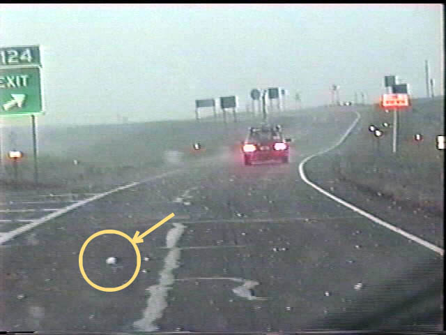 |
Just before leaving we started getting some larger hail. We picked up a
golfball hailstone for photographs, but there were larger ones on the way! Back on I-40 we
started getting pounded by baseballs, and some even larger. The circled hailstone is on
the pavement, not in the air...probably a good 4" in diameter! We tried to escape going south on 70, but we only ended up driving right through the hook on the storm. We got pelted by hailstones being blown sideways by 70 mph winds. This meso was really cranking up! |
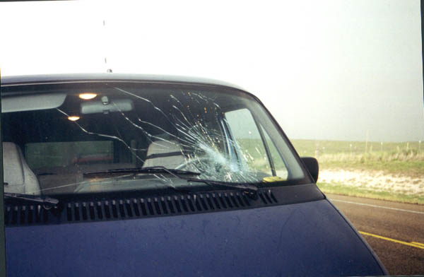  |
Vehicles don't like this very much. One van got its windshield completely smashed. Another got a whole bunch of hail craters...a lot of them were on the SIDE from the blowing hail! |
 |
After the second meso gusted out big time, we tracked the next one which produced an amazing mothership appearance, but no tornado. View is looking WSW at about 8:30 pm. |
May 14 | May 16 | May 20 | May 25 | May 26 | May 31 | June 5