 |
|
Started out in Norman and left at around 10 to eat at Sonic and then headed west on I-40. Stopped in Clinton, OK, to get some data at a truck stop. Decided best chances were north, so we headed north on 183 and then NW on 270 into Woodward. Tom Warner spotted the beginnings of a tower to our NE, so we took 34 north as the storm exploded, forming a continuous overshooting top. We finally hit 64 and we blasted east at 80 mph. Anvil was real crisp even through the haze.
|
|
  |
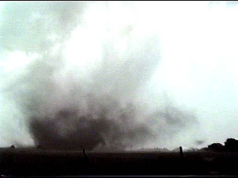
About 2 miles east of the turnoff to Wakita on Rte 11, we watched a landspout form to our west as the RFD cut into the main meso. |
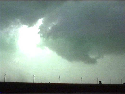 |
The RFD cutting into the meso as seen just north of our position on Rte 11. |
 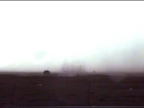 |
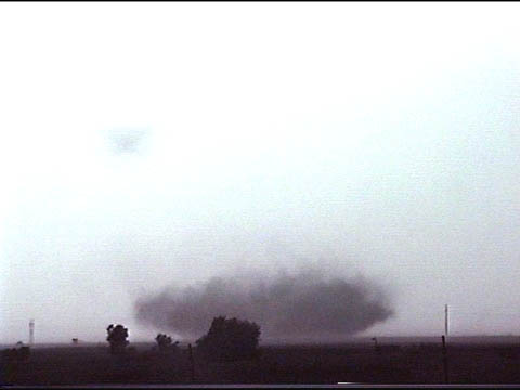
A bit further east on Rte. 11, we watched several suction spots spin up underneath the meso out in a field to our north about 1/4 mile away. |
|
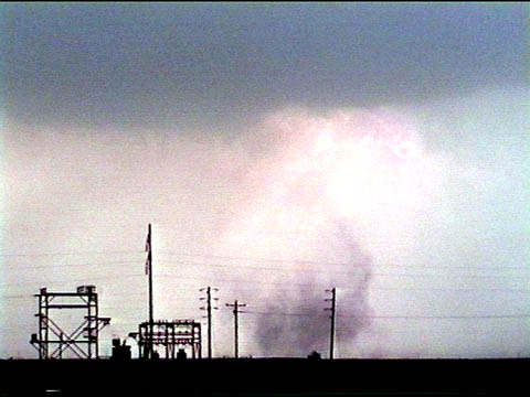
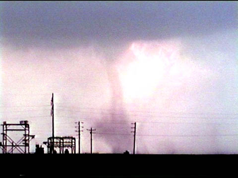
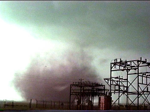
A tornado formed shortly afterwards and began to track southeast towards us. We turned around and headed back west on Rte. 11 to the power substation seen in the first set of images above. A small funnel was visible at this time. After this one dissipated, we headed back east on Rte. 11 and watched yet another tornado spin up where the first one had been. |
After some cool video, we continued blasting east on 11 into Medford and then turned south on 81 to try to stay ahead of the storm. Turned back east on 60 and into Lamont where we found shelter from the hail in a rickety shed.
|
Just before pulling into Lamont, we noticed the main updraft was really
corkscrewing around, indicating strong rotation. One look at the reflectivity image shows this clearly. This next picture is
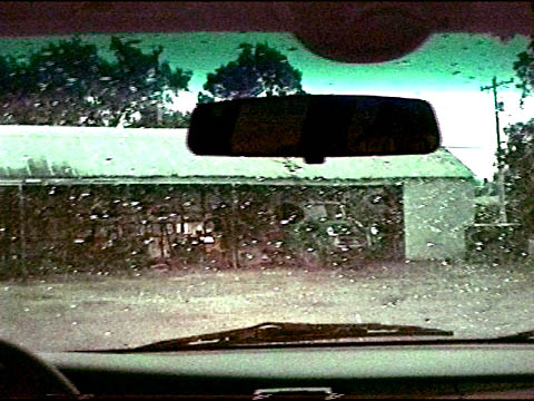
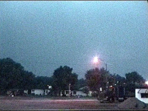
the shed where we took shelter from the hail in Lamont. Hail at this time was falling out
of the storm's anvil and ranged in the golf ball size. The third view is from inside the
shed looking out the the west. If you look carefully, you can see the LARGE bell-shaped
lowering just above the lamp post. The tornado was just about to our WSW at this point. We stayed in the shed among the tornado warnings from about 8:30 to 9:20 when the winds suddenly shifted and we got the heck out of there! Blasted north on 74 and then east on 11 to I-35 where we met the rest of the group and then headed home. |
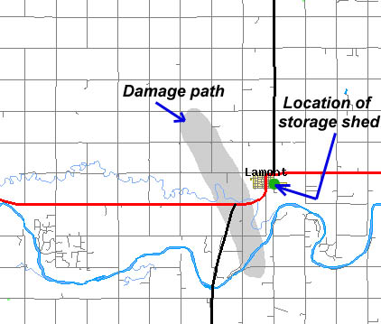 |
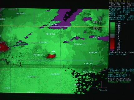
Our location in relation to the later-determined damage path. Straight
line distance to the edge of the path is less than 1 mile! Click HERE for radar reflectivity of the storm at 9:18 PM CDT Click HERE for doppler velocity of the storm at 9:18 PM CDT
|

