The following radar and velocity images are taken from the NWSFO, Albany homepage.
They have many more damage photos and other useful information.
Click on any image for a larger version
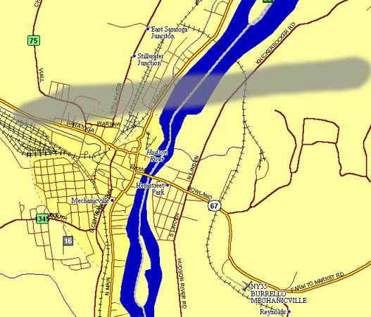 |
This is a damage path map I prepared based on what I saw on my drive out there today. I didn't go down too far on Rte. 67 because I didn't see any more obvious damage. The whole area north of 67 is on a ridge that gradually slopes down to the east into the Hudson River. More damage was evident on the east side of the Hudson. There was also sporadic damage on hilltops further east near Schagticoke as the tornado skipped from hilltop to hilltop. |
 |
A 4 panel reflectivity image of the Mechanicville tornado as it approached the area. |
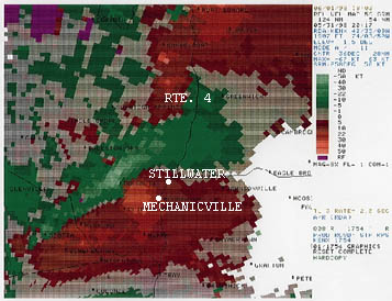 |
A doppler velocity image of the tornado as it approached Mechanicville around 4 PM. The tornado was already doing damage on the ground at this point. |
 |
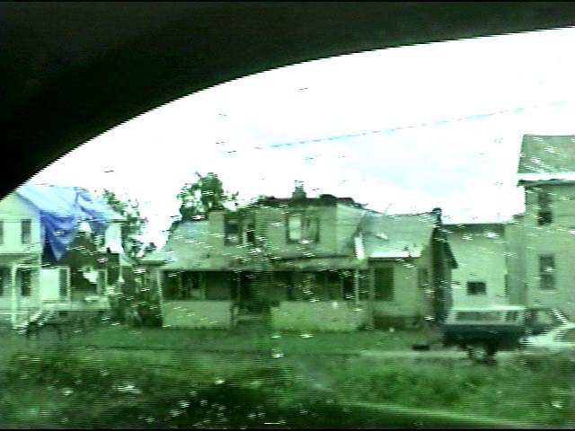
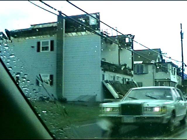
In Mechanicville on Rte. 67 looking north. This house was demolished with only the walls left standing. Looks to be F3 damage. |
 |
Looking south from Rte. 67 in Mechanicville. This house had its roof torn off completely, partially causing damage to the house next door. |
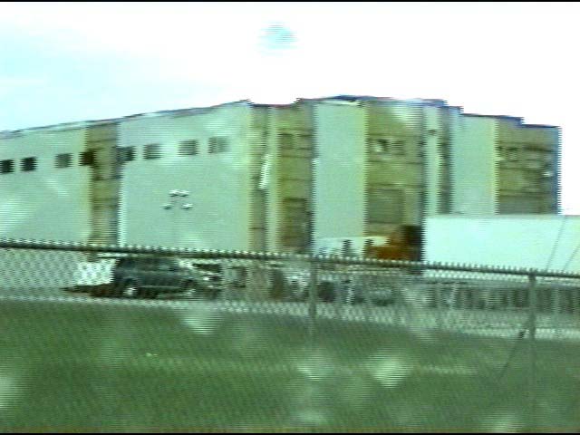 |
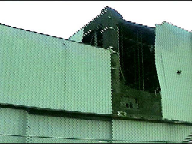
Approaching Stillwater on Rte. 4 looking NW. This warehouse had most of its sheet metal stripped away, exposing the brick structure. |
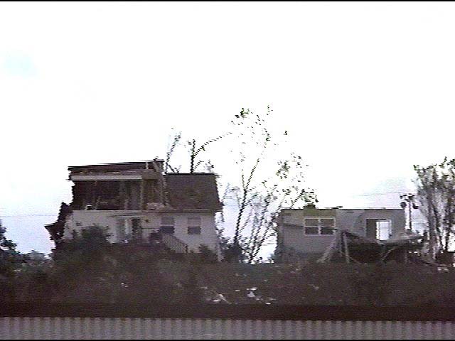 |
On Rte. 4 looking due west. This house was destroyed along with several others on this ridge overlooking the Hudson River. |
 |
Further north on Rte. 4, this house had its front wall blown out and its roof torn off. This house was directly on the shore of the Hudson River facing east. |
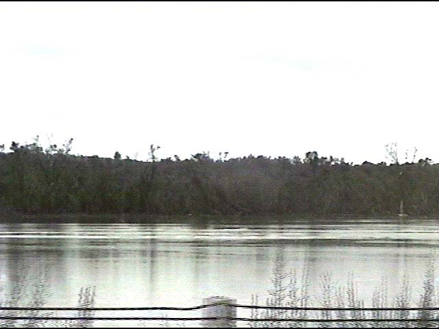 |
Taken from Rte. 4 a few hundred feet from the house above. Looking across the Hudson to the east at the damage path the tornado created as it left Stillwater. |
 |
Looking east on Rte. 4 at another warehouse with sheet metal siding and a portion of a brick wall ripped away. |
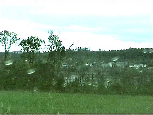 |
From the other side of the Hudson looking back west on the town of Stillwater and the damage track. The houses on Rte. 4 that were damaged can be seen on the other side of the Hudson. The tornado crested the ridge in the distance, where the most damage was done and headed towards this spot. It continued east, skipping across ridges and hilltops, causing sporadic tree damage. |