![]()
June 12 - 16, 2009
| June 12th - Sightseeing in the Colorado Rockies | |
| One of very few sightseeing days. We decided to make the most of our High-Plains location and went to Colorado Springs to go up Pike's Peak and have some good local food! | |
 |
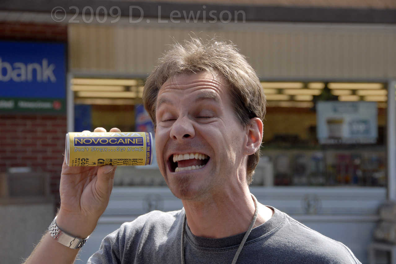 |
| Our group takes a moment to talk to a respected chaser veteran: Dave Hoadley. | George tries yet another power drink. Minor side effects... |
 |
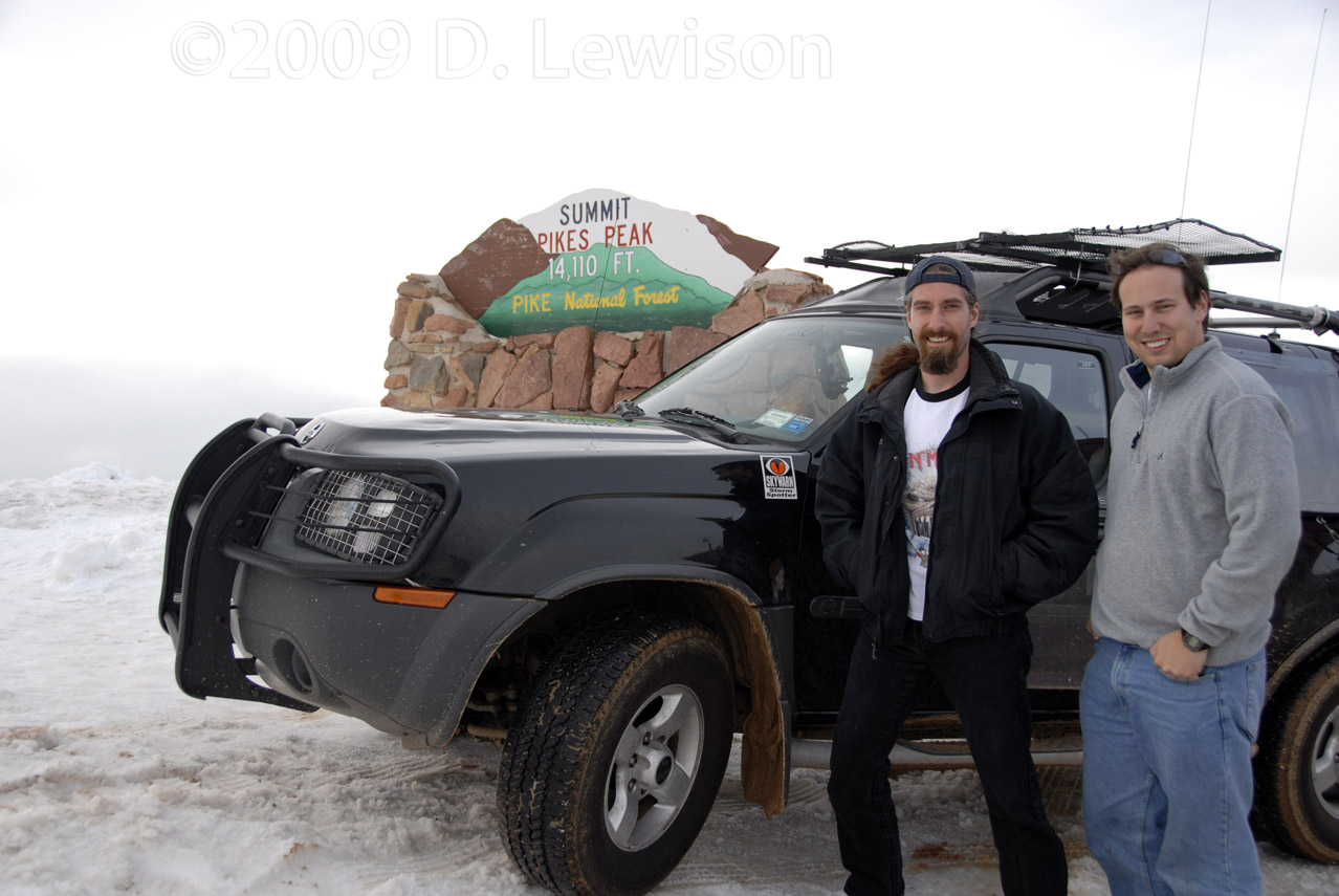 |
| On the narrow, winding, guardrail-less road up Pike's Peak. | Made it! 14,110 feet. We look fine here, but it was pretty difficult to breathe in the thin air. Couldn't really move too fast without getting winded. |
 |
 |
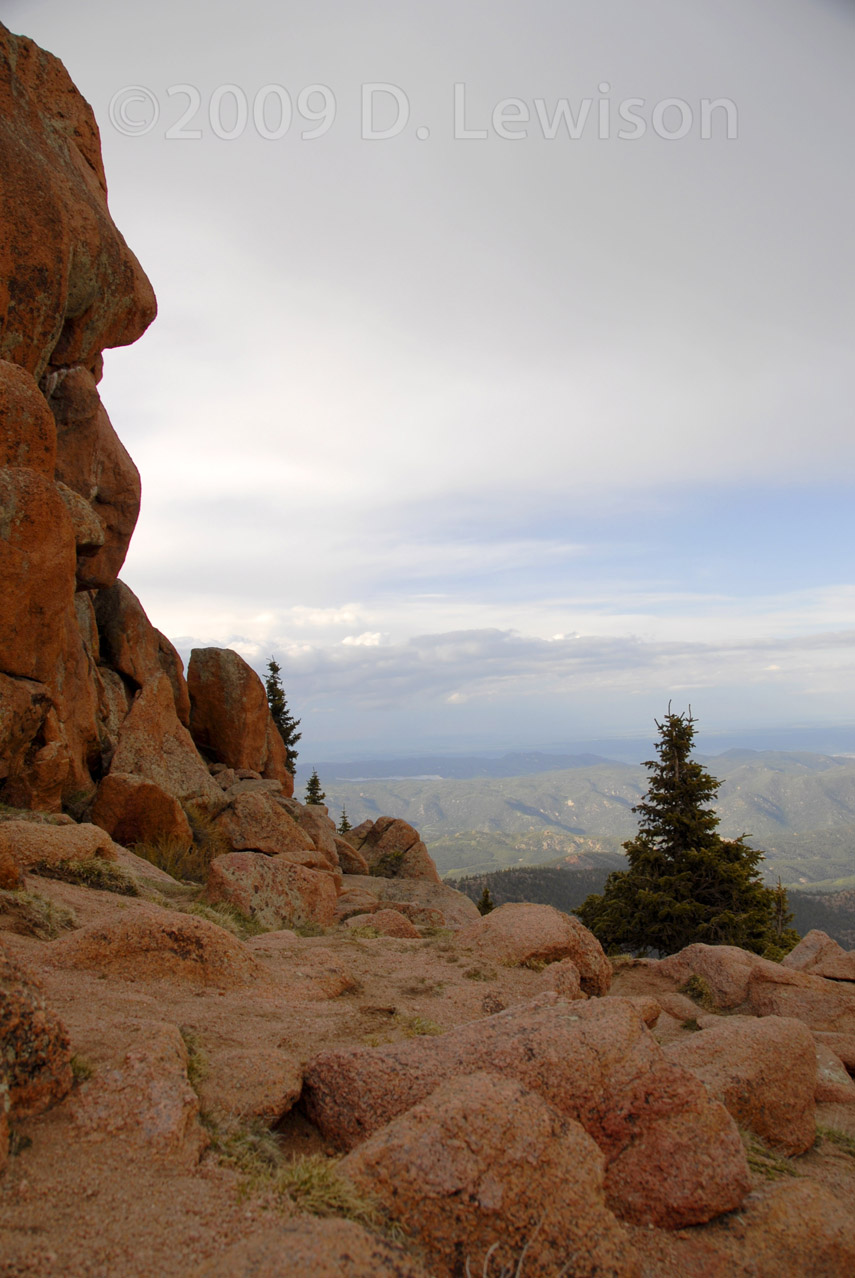
| One the way back down the
mountain. Reminds me of Wile E. Coyote's habitat. |
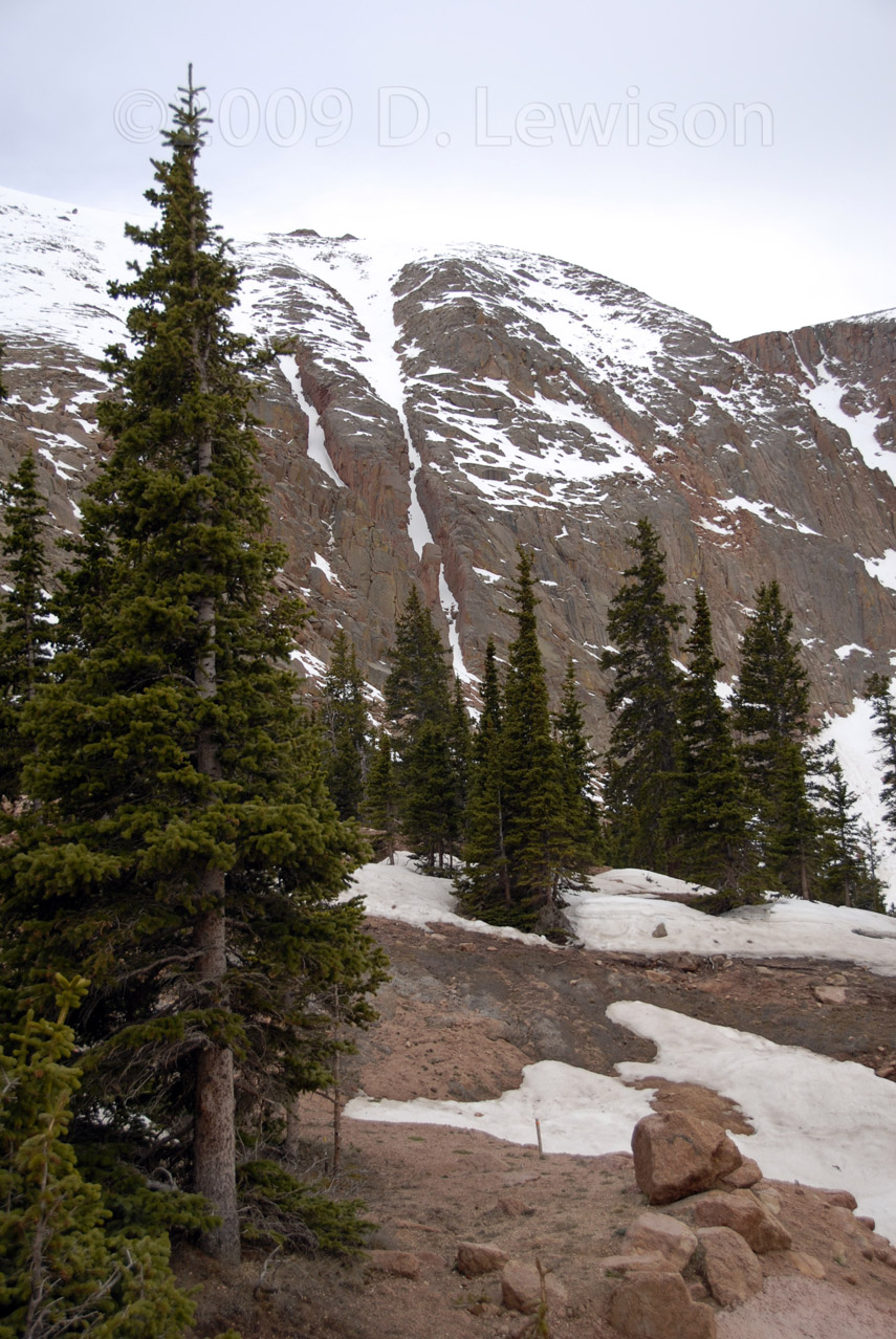
Pretty pines line the mountain road. |
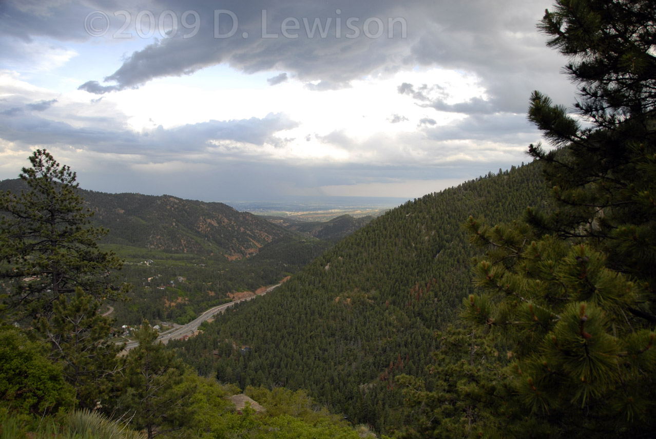 A look down the valley towards Colorado Springs. |
|
| June 13th - HP Supercell in the TX Panhandle | |
 |
We awoke in Colorado Springs, only to realize that
our target had shifted waaaay down into the TX Panhandle! The mad dash began in the early morning and we drove all day towards the Amarillo area. 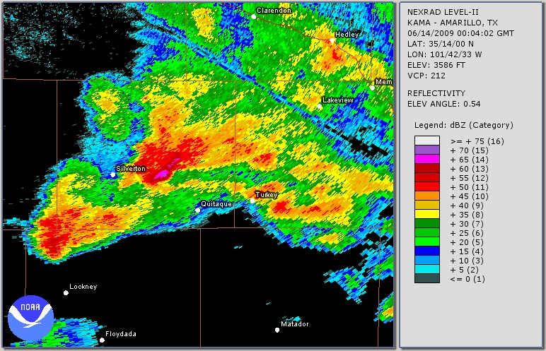 |
 |
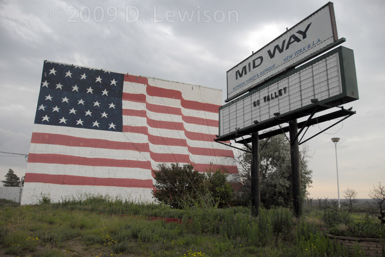 |
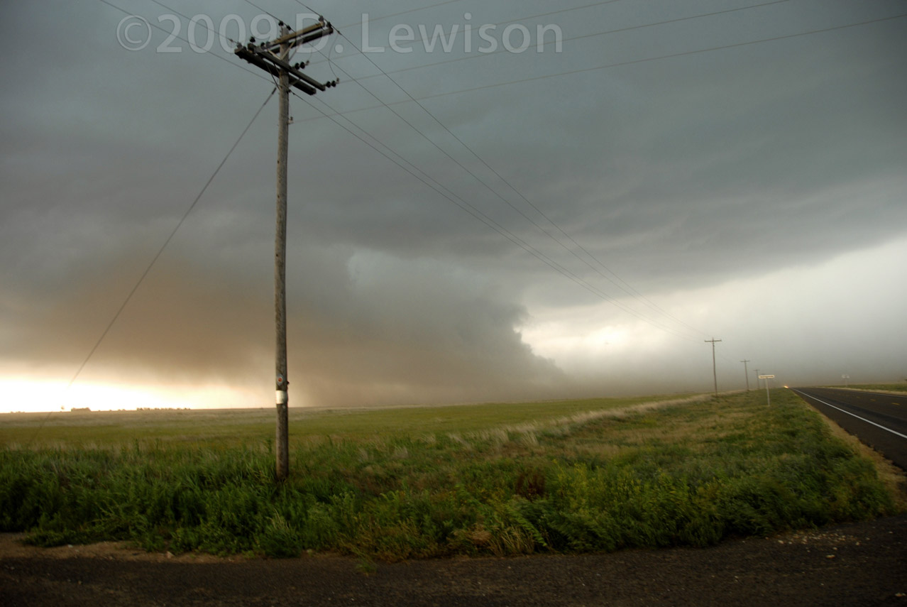
| Didn't take many still photos today. This is what we drove through, during one of the more intense white-knuckle drives I've been on! Atomized horizontal rain isn't good. Luckily it wasn't a tornado...But this updraft was sucking in dirt at over 30mph! | The storm didn't end up doing much. Got some nice "Americana" shots near Quitaque TX before heading up to Shamrock for the evening. |
| June 14th - Surprise! Tornado! SW Kansas | |
 |
What a great day! Didn't have high hopes, but we meandered northward from TX into KS where we saw a little cell developing near the CO border. The rest was, shall we say, exciting! |
 |
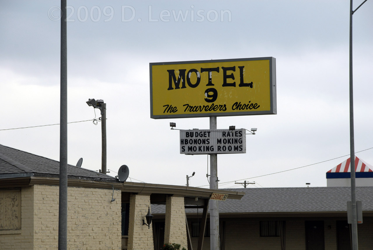 |
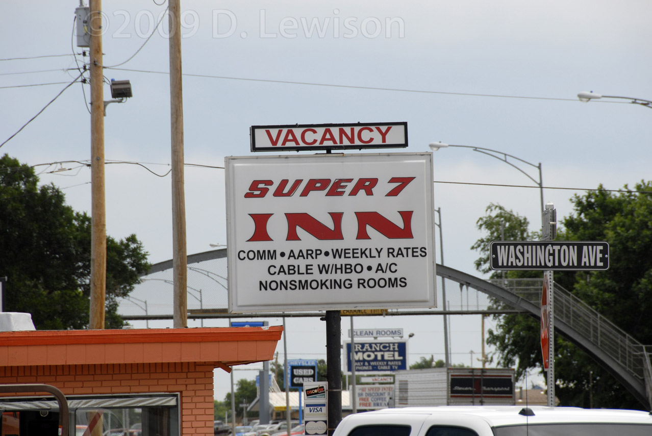
| Not quite as good as your standard "Super 8 Motel" |
But I guess this one is better!! |
 |
 |
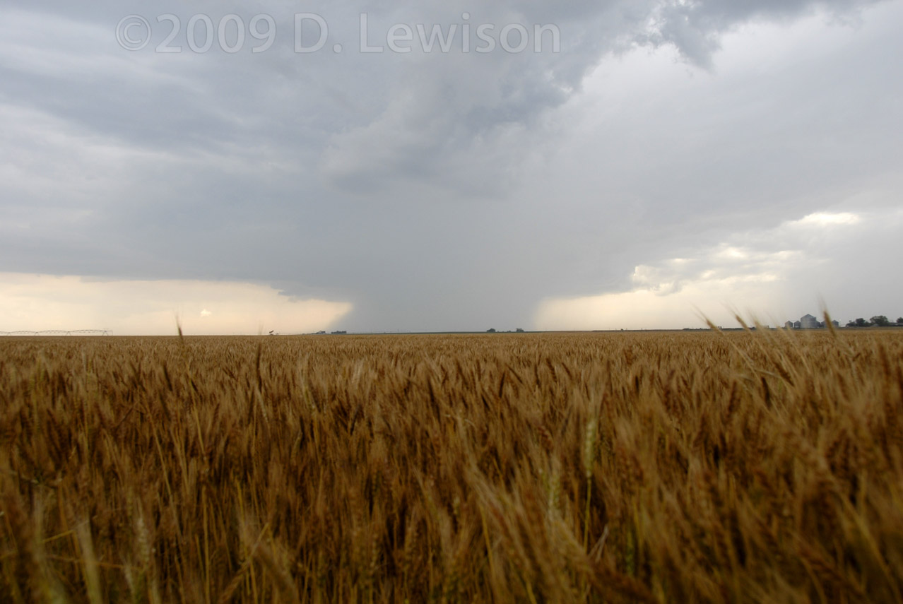
| The fledgeling supercell develops a rain core near Johnson City KS. | As the cell drifted eastward, we followed along Hwy 160. It looked kinda of outflow/shelfy. But the mini lowering to the left of the power pole was rotating rapidly! |
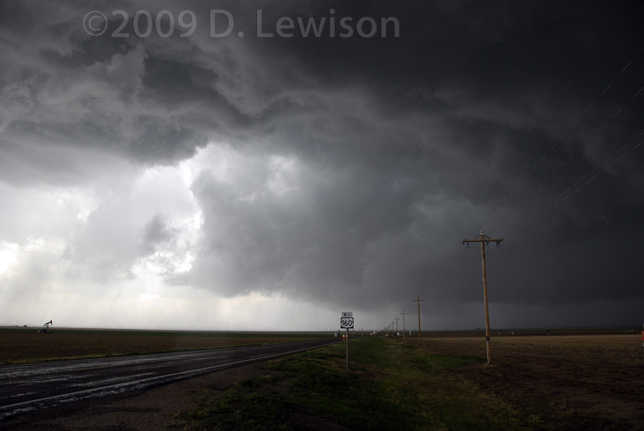 |
|
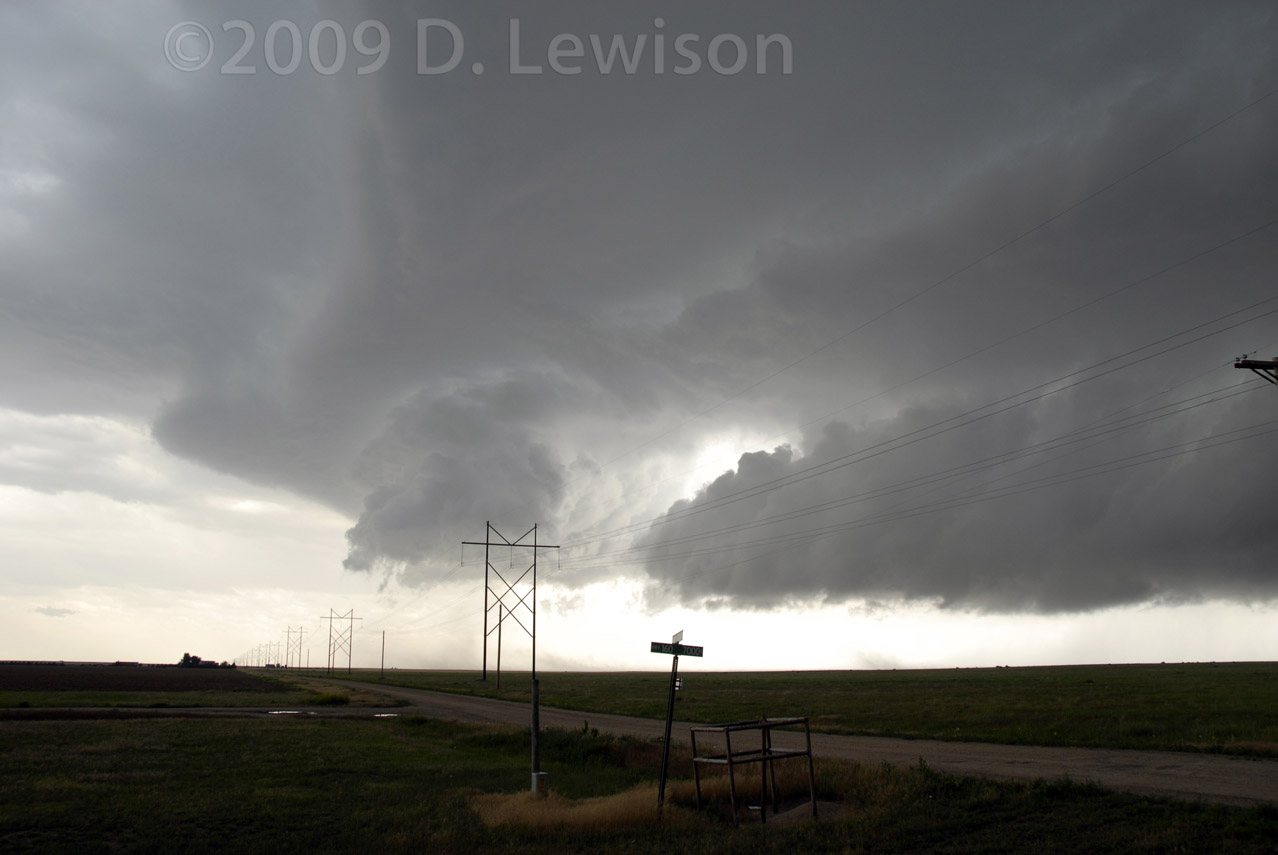
| This rotation consolidated into a more classic wall cloud with RFD cut. As we drove east down 160, I was complaining how I couldn't see behind us due to dirt on the rear hail guard. Scott suggested I take a look in the side view mirror. Surprise! A tornado was churning in a field just behind us! | |
 |
 |
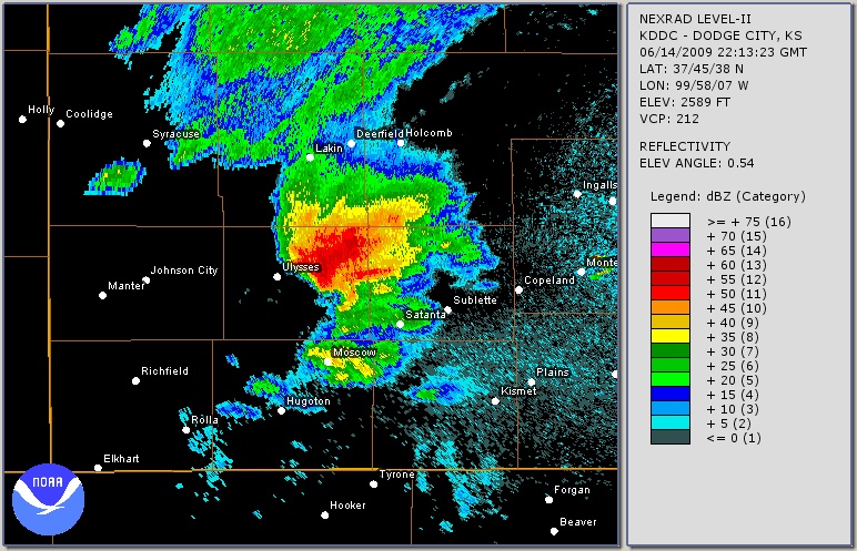
| A radar image of just after the tornado touched
down. Nasty HP supercell structure, with small hook. |
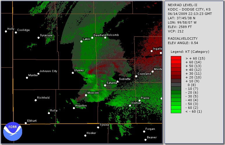
A Doppler velocity image at the same time. The velocity couplet (red/green) is clearly visible just SE of Ulysses. |
 |
 |
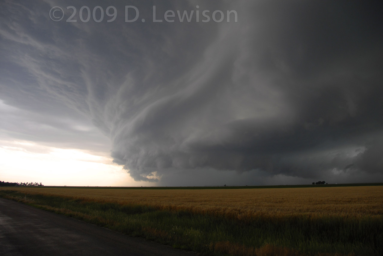
| After the tornado, the storm took on a banded HP appearance. | We're racing south ahead of the core now. Blocky wall cloud and RFD cut are visible center frame. |
 |
 |
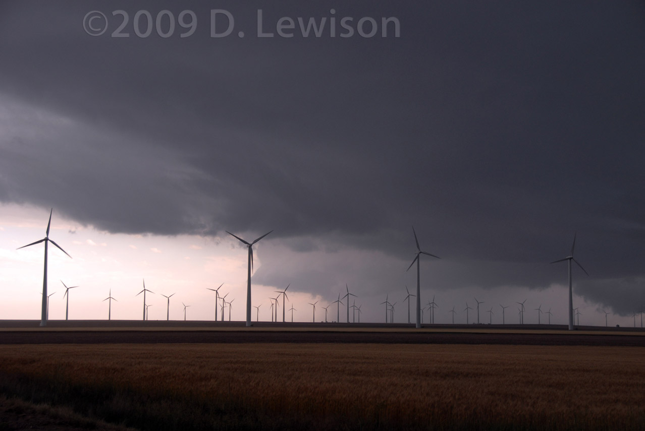
| I convinced Scott to stop for a second so I could
get some pretty shots. I like wind farms. :-) The storm went outflow dominant shortly after this. |
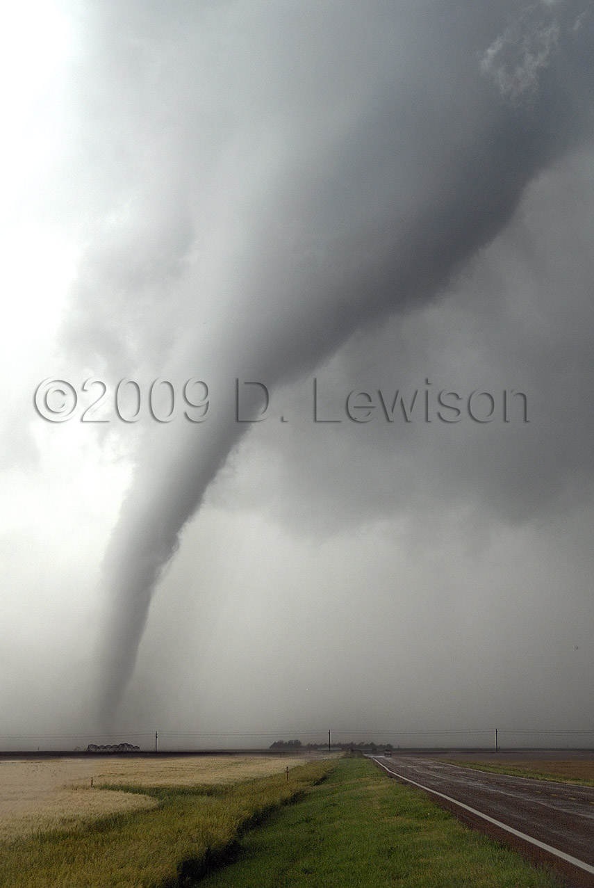
Here's a contrast-enhanced version of the Ulysses tornado. |
| June 15th - Messy Gustout in SW Kansas | |
 |
Kind of a frustrating day in SW Kansas. Started the
day in Dodge City, right in the bullseye of our target area. But once storms did get going, they all went at once, making choosing a target cell difficult. We went west towards the first storms, but then saw this beast go up to our east. 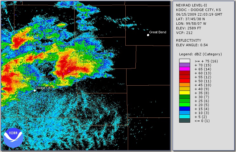 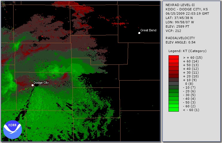 |
 |
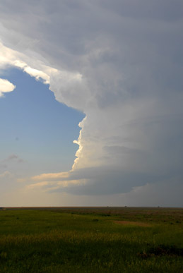 |
| Scott McPartland and Mark Robinson hard at work forecasting...Well, one of them is. See if you can guess which one? | Late afternoon, the first cells went up west of Dodge City KS. This was a pretty LP supercell that had the potential to do so much more, if the storm to it's south hadn't killed it. |
 A radar image of the storm as we finally got out in front of it. Storms to the west had merged with this one, making for a huge mess with an embedded circulation on its northeast side. We decided to sample the massive gust front instead (thin blue line pushing to the SE on the south side of the storm). |
|
 |
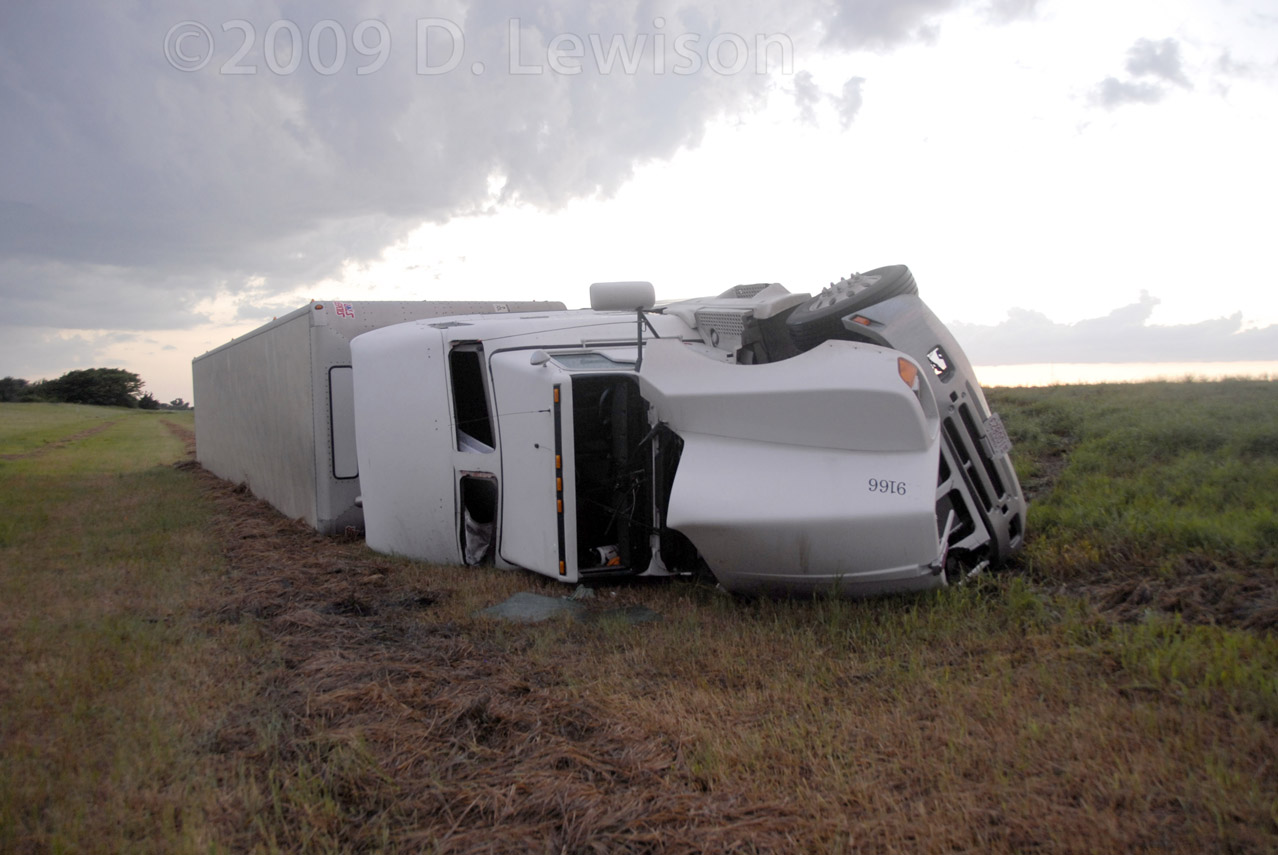 |
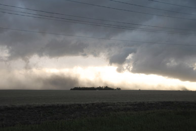
| The dominant HP monster supercell rolled through Dodge City and became an outflow mess. Here's the dust cloud being raised up by the 50-60mph gust front winds near Greensburg KS. | Not a good time to be in a tractor trailer during strong crosswinds! |
 |
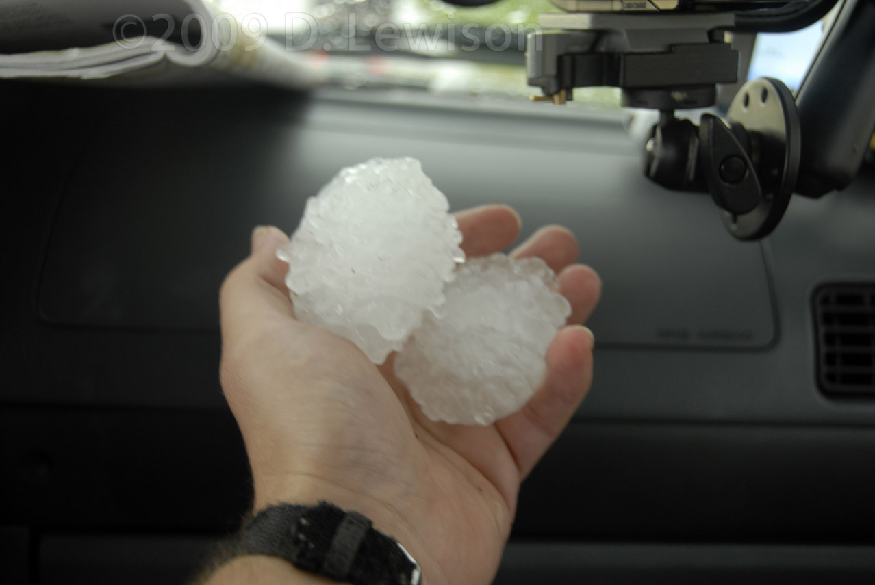 |
| We headed back towards Dodge City to sample a couple smaller supercells that popped up. | These small storms had some surprisingly large hail! The hail guards got another fun test. :-) |
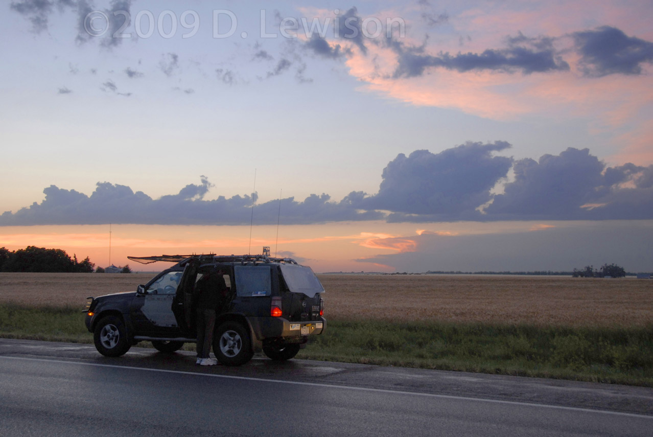 Wrapping up the day and watching another picturesque western KS sunset. |
|
| June 16th - Evening Supercell in Central Kansas | |
 |
A nice surprise ending to a near-bust. Drove from
Dodge City to eastern KS and saw nothing but blue sky. Saw an isolated supercell going up 2 hours back from the direction we had come! Nothing to do but backtrack....and quickly!!! |
 |
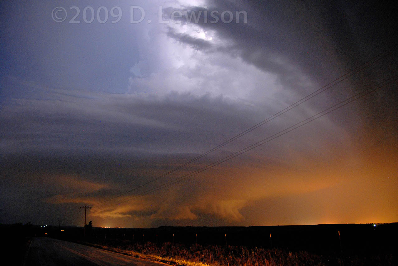 |
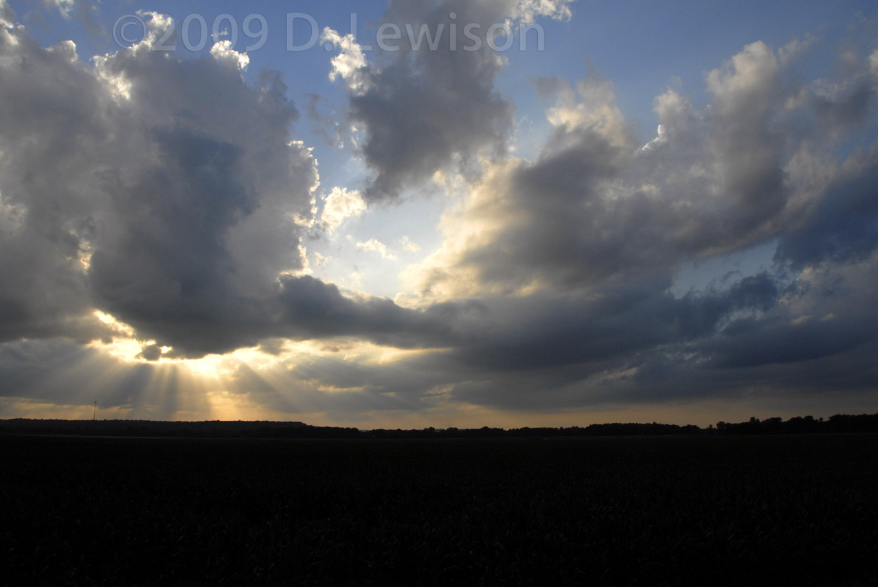
| Hanging out in far eastern KS, waiting for storms that would never form. | The real (and unexpected)
action took place 100 miles back in the direction we came from, near
Wichita. We blasted back west just in time to see a nearly stationary supercell over the town of Winfield KS. |
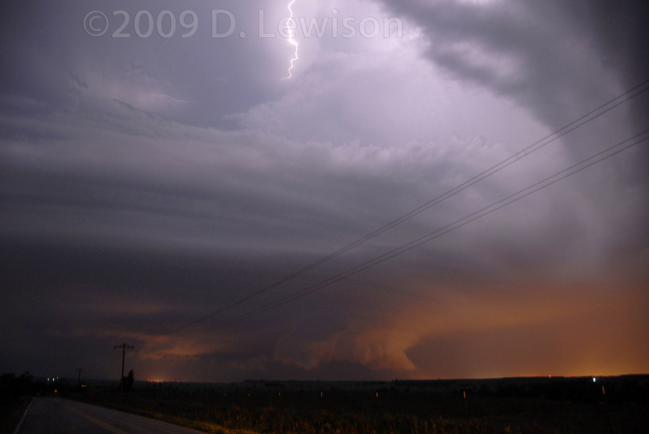 Really beautiful structure shots with some lightning, illuminated from below by the town. |
|
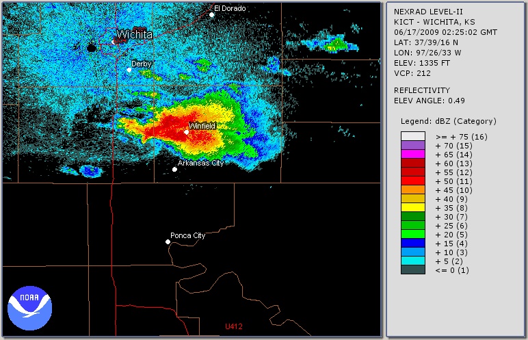 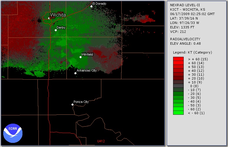 Radar and Doppler velocity images of the storm at about the time these photos were taken. |
|
All Images c. 2009 Dave Lewison. No reproduction without permission.
| Go back to MAIN PAGE |
[an error occurred while processing this directive]