|
Started the day in Woodward, OK. Much of the town (including the Super 8 we stayed at) was without phone lines due to the large MCS that moved through the area the night before. We attempted to get data at a local truck stop with no success. After a few cell phone calls to Jay Antle & Steve Sponsler, we ascertained that there was a MDT risk for the TX panhandle, so we decided to head that way via the OK panhandle and get data in Dalhart. After getting some much needed information in the afternoon at a Holiday Inn Express in Dalhart, TX, it appeared that the entire TX panhandle was covered by thick mid-level grunge from earlier convection. We hoped that by staying north of it, we could get into clearer air. So, we headed towards Clayton, NM. Hung around there for about an hour waiting for stuff to fire. At around 3:30 or so (MDT) the first severe warning came over the WXradio for northern NM, about 90 miles to our NW. I put in a call to Philip Flory to see what was going on. After hearing that this was the only cell going up, we decided to take a chance and go after it. We went up 87 in NM, and then jogged north on a crazy, mountainous road just east of I-25. |
  |
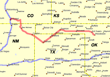
Caught 160 in CO and headed west towards the
cell. It was a pretty LP supercell which exhibited nice inflow and rotation for a while,
until it crossed the mountain range and died. A second LP formed in almost the same position as the first. It then died a similar death. |
  |
We then caught up to Scott Blair & Jason Politte near the town of Trinidad, CO, enjoying some marble size hail. We hung around there for a while, and noticed a third LP cell going up right where the other two had formed. |
  |
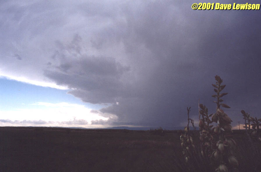
It gradually organized into a beautiful LP with a striated "mothership" appearance. It began forming an inflow tail to the northeast and started sucking scud off the mountains. We followed this storm a bit further northeast up Rte. 350. |
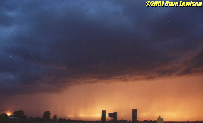 |
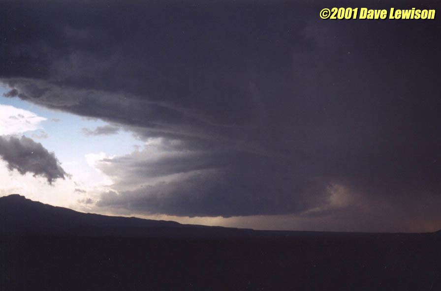
Further up the road, we were treated to a great sunset behind the falling precipitation. |
 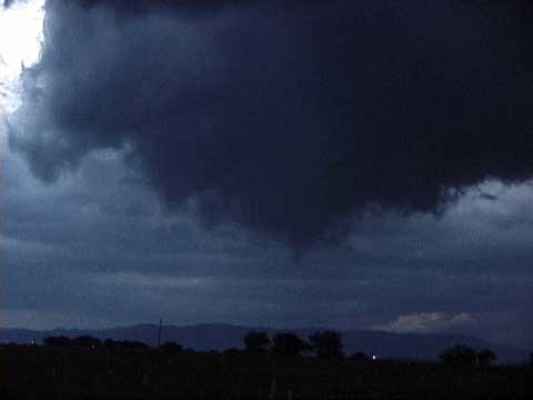 |
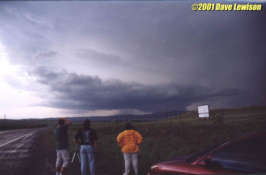
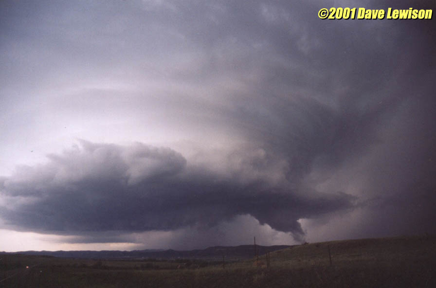
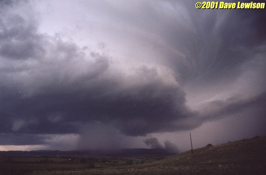
The supercell soon developed a nice wall cloud. However, after this, it became more disorganized and the meso fell apart. No worries! ANOTHER LP had formed right over the same area as before and began to organize. It soon developed a nice rounded base with a wall cloud. A pronounced dry slot began to cut into the base, making the wall cloud circulation tighten up. |
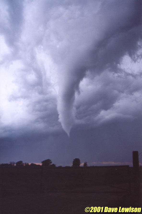  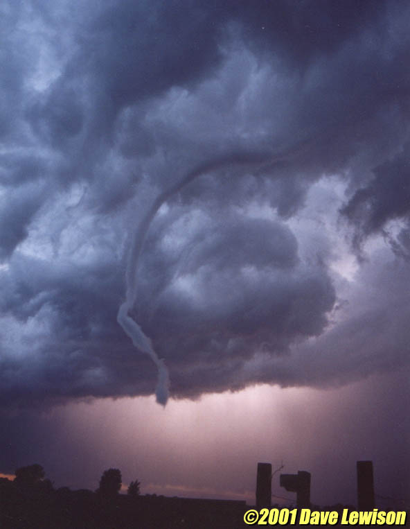 |
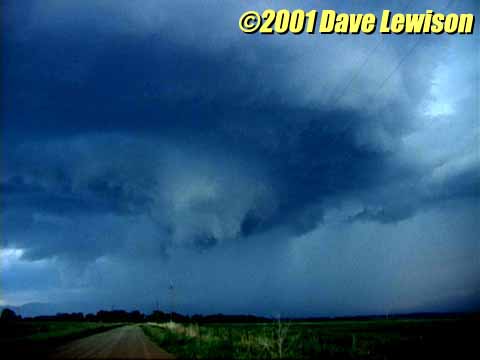
Numerous funnels formed and dissipated around the circulation as the dry air punched further in. Gradually, one main funnel formed and crept closer to the ground. Violent downward motion was visible on the left edge of the wall cloud. It soon took on a contorted rope shape, snaking high above our heads into the cloud base. It gradually roped out, backlit by nearly continuous lightning. |
What a day! :-) I want to thank Philip Flory for nowcasting for us & Scott during this whole event...great job! |
|