
 |
These two days showed lots of promise, but ended up not
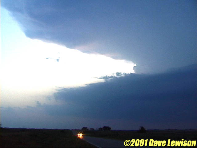
producing anything too spectacular. On June 3, all signs were pointing towards the Cherokee to Wellington area. A Tornado Watch Box indicating the possibility of 4" hail was also encouraging. However, the cap was very strong...and it didn't break until about 8:30 pm. We were able to get a few glimpses as the storm rapidly developed inflow banding and a ragged lowering. However, as it moved northeast, it crossed the warm front and subsequently died. |
 |
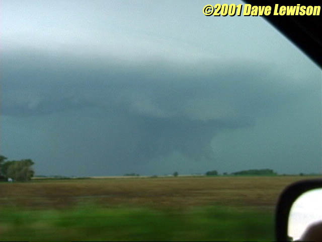
Another day in southern KS. This was the view just south of Argonia. A well-defined meso with a suspicious wall cloud. Entering the town and crossing the RR tracks, it developed a pronounced funnel. We could not confirm if this touched down. |
 |
Further east, we got a nice view of the HP meso. Visibility was very poor near the wall cloud area, but I do not believe we saw any funnels. The storm gusted out shortly thereafter and dumped copious golfball hail near Wellington. (We stayed just ahead of it). |